


The Not-So Good Old Days
- Douglas Miller
- Feb 21, 2023
- 4 min read
Updated: Feb 23, 2023
If you missed any instalments of The Watershed's Alberta Creek Debris Torrent series, be sure to click through to read Forty Years of Change, A Sombre Anniversary, and Forty Years Ago This Week.
A personal reflection on the development of the 'Sea to Sky Highway'
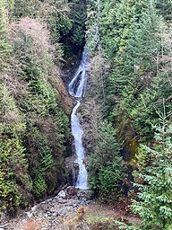
Anyone paying attention to current events in the early 1980’s was aware of the disasters in the Howe Sound area caused by debris torrents that thundered down the mountainside creeks.

Nine people lost their lives at M Creek just north of Lions Bay on Highway 99 in 1981. Two years later, our community was literally torn in two by the catastrophe in Alberta Creek. Highway 99 became known regionally as “The Highway of Death”.
At that time, I was working in Vancouver television newsrooms, presenting the weather segments in the evening newscasts. One day following these two unfortunate events, the news director asked me to advise him whenever Environment Canada posted an extreme weather warning for Howe Sound. When I inquired as to why he wanted that information, he stated that a crew would be posted overnight at Horseshoe Bay whenever such warnings were issued. The intent was for our station to be the first 'on scene' at the next disaster. Fortunately, there wasn’t another event of this magnitude and the crews got some sleep in the van.
Fast forward only three years following the Alberta Creek debris torrent; Vancouver was welcoming the world to Expo 86. It had a huge impact on the region and even today is widely recognized as the biggest turning point in the modern history of Greater Vancouver.
There was excitement in the air as millions of people from around the world descended upon the city. It was obvious that they liked what was discovered here. As a renter in West Vancouver, I felt it was the opportune time to get back into property ownership before values likely started to rise.
Having visited friends residing in Lions Bay in the past, I knew that the area contained a great mix of urban and rural. The only downside for me was the 'Highway of Death'. Not only did it have an unfortunate history but it also seemed like a long way to commute in and out of the city on a daily basis. Nevertheless, my attraction to the area overcame my concerns. I asked my real estate agent to arrange a tour of available properties in Lions Bay.
I found the house that I wanted to buy the very first day of looking. And it has been home for the 37 years since.
I admit to a degree of 'buyer remorse' in the period between signing the purchase contract and taking possession of the property. This occurred in the depth of winter and I felt compelled to drive out to the Village from the city on weekends in anticipation of moving to the community.
In those days, the highway north of Horseshoe Bay was made up of two lanes that closely followed the contours of the mountainsides. It took some time before I could drive the road confidently without feeling somewhat concerned going into every corner. How much did I need to slow down? How long was the corner and what came after it? Needless to say, I often had a line of vehicles following closely behind me and they were driven by folks with something less than pleasure written across their faces!
It wasn’t just debris torrents in the creeks that created mayhem on the highway. More lives were lost to driver error than due to washouts. Some people drove too fast, some people drove carelessly and some drove drunk. Some managed to cover all those bases and many lives were lost in the process.
It was not uncommon during those times for families to move out of Lions Bay when their children approached driving age. This was not a road that many parents were comfortable having their offspring using as they learned to drive.
Twenty-four years after my move to Lions Bay, Vancouver once again rolled out the welcome mats, this time for the 2010 Winter Olympic Games. As the event was co-hosted by Whistler, it became necessary to improve the road linking the two venues. Thanks to the taxpayers of BC, the road leading to Lions Bay morphed into a modern, safe, four lane, divided highway. This enables slow drivers to now enjoy the drive while travelling in the outside lane, leaving the passing lane for those drivers who are in a hurry.
As I recall, this was the point where the 'Highway of Death' moniker gave way to the current label, “Sea to Sky Highway”. A better name, reflecting a much-improved roadway.
Occasionally I like to remind myself of what the old version of the highway was like to drive. When going into the city on days with time to spare, I will leave the highway just past Ansell Place/Seascapes where the signs say “Marine Drive via Horseshoe Bay”. From that point, the road is the last remaining section of the old highway configuration. It winds its way down to Horseshoe Bay in the manner that the old road did all the way to Whistler.
Driving that section of road at night in the middle of a rainstorm will give you a more complete picture of what we all too often had to endure prior to 2010.
It is a small reminder of the 'not-so good old days'.

Great tit-bit of Lions Bay history!